New England Archaeology
Jump to Navigation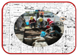
Archaeological Management Plan for Armidale (AMPA)
This project was in partnership with Armidale Dumaresq Council and the NSW Heritage Office. Archaeological sites within the City of Armidale were systematically identified from historical documentation. They were then recorded, mapped and assessed for their current condition, significance and potential. There are individual entries for each site in the database. The fields and data are compatible with the NSW State Heritage Inventory and the results will be integrated with the Local Environment Plan for reference in strategic planning and development.
For further details, browse the database entry on Armidale and its related records, especially the list of sites.
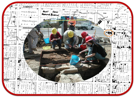
The photograph shows excavations at McLean's Corner, Armidale, 2002 . UNE archaeology students are exposing the foundations of the 1873 store overlapping the east end of the 1850s house (now on public display in a viewing window on the corner of Marsh and Dumaresq Streets). The background is a detail from the 1867 Ratings Map of Armidale showing footprints of existing buildings. McLean's Corner is circled.